
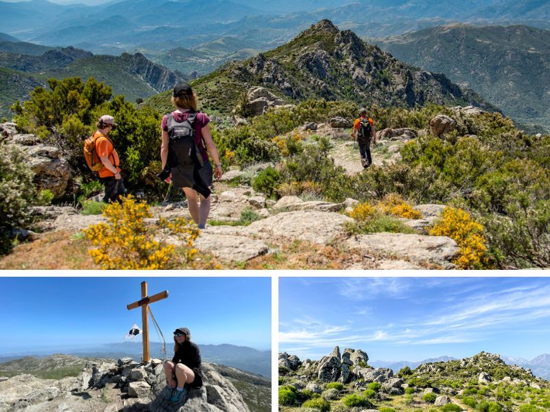
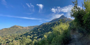
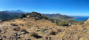
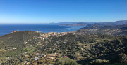
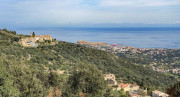
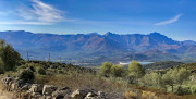
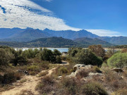
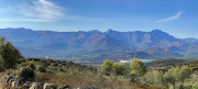
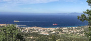
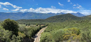
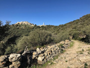
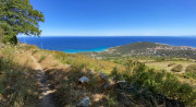
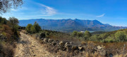
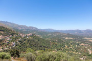
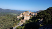
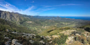
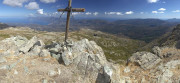
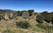
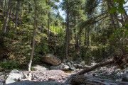
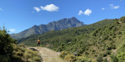
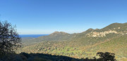
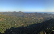
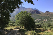
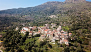
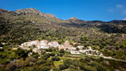
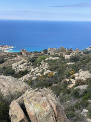
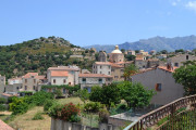
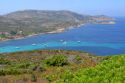
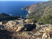
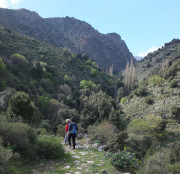
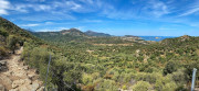
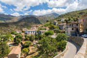
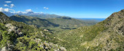
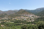
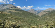
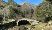
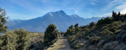
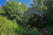
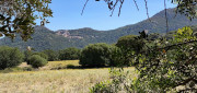
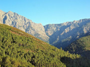
Explore the unspoilt splendour of Lisula along our trails, which bear witness to the history and links between our inland villages. Covering over 350km, we offer a variety of experiences from the rugged coastline to the majestic panoramas of the Ghjunsani Mountains. Our routes follow ancient mule tracks, allowing you to immerse yourself in our cultural heritage. Choose from picturesque loops linking villages, coastal paths with breathtaking views of the Mediterranean or mountain routes for those seeking a challenge.
The Heritage Trails take you to places rich in history and reveal the hidden treasures of our region. Whether you're an experienced walker or a beginner, our trails vary in difficulty to suit all levels, with walking times ranging from one hour to over six hours.
Get ready for an incredible, immersive experience in the heart of nature! Every path tells a story, every bend reveals a breathtaking landscape, and every step brings you a little closer to the authentic charm of Lisula. Welcome to a hiking paradise where adventure awaits you in the heart of the maquis!
10.1km 330m 330m
Corbara
Route opened
6.2km 250m 250m
Pigna
Route opened
3.8km 220m 220m
Corbara
Route opened
8.8km 430m 430m
Corbara
Route opened
3.7km 140m 150m
Santa-Reparata-di-Balagna
Route opened
12km 410m 410m
L'Île-Rousse
Route opened
11.4km 320m 320m
Santa-Reparata-di-Balagna
Route opened
1.5km 40m 40m
Monticello
Route opened
7.4km 280m 280m
Monticello
Route opened
7.7km 270m 270m
Monticello
Route opened
11.8km 580m 580m
Santa-Reparata-di-Balagna
Route opened
6.1km 290m 290m
Santa-Reparata-di-Balagna
Route opened
39.5km 1520m 1520m
L'Île-Rousse
Route opened
27.9km 820m 820m
L'Île-Rousse
Route opened
9.3km 410m 410m
Belgodère
Route opened
11km 690m 690m
Belgodère
Route opened
13.2km 1060m 1060m
Lama
Route opened
3.7km 210m 210m
Pietralba
Route opened
12.2km 600m 600m
Vallica
Route opened
14.5km 690m 690m
Olmi-Cappella
Route opened
5.6km 270m 270m
Occhiatana
Route opened
8km 380m 380m
Speloncato
Route opened

3.4km 130m 130m
Feliceto
Route opened
4.7km 210m 210m
Nessa
Route opened
11.8km 810m 810m
Montegrosso
Route opened
5.2km 210m 210m
Montegrosso
Route opened
4.7km 280m 270m
Lumio
Route opened
10km 510m 510m
Lavatoggio
Warning
13.7km 280m 280m
Calvi
Route opened
16.5km 1070m 1070m
Galéria
Route opened
8.7km 270m 270m
Galéria
Route opened
11km 260m 260m
L'Île-Rousse
Route opened
4.5km 600m 20m
Urtaca
Route opened
3.4km 230m 230m
Lama
Route opened
9.5km 750m 750m
Pietralba
Route opened
7.2km 370m 370m
Vallica
Route opened
2km 80m 80m
Pioggiola
Route opened
8.6km 340m 340m
Pioggiola
Route opened
8km 400m 400m
Feliceto
Route opened
7.1km 80m 80m
Algajola
Route opened
16.9km 1240m 1240m
Manso
Route opened

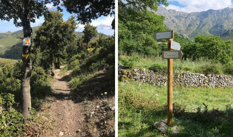
Hiking routes are signposted with paint markings of different colours. Hikers will also find wooden signposts along the paths, systematically and uniformly indicating directions.
Safety and fun : our priority
Plan your next outdoor trip carefully.
Safety first : I share my itinerary and planned times with someone close to me for shared peace of mind. I use our mobile app to check the condition of the route before I set off
Check your equipment : make sure it's in good condition and suitable for the activity you're undertaking.
Weather conditions : I check the weather forecast to prepare and make the most of my trip. Routes can be dangerous in bad weather Hydratation is essential : jI need to carry enough water. Some of the stages in the villages allow you to stop at a bar or café for refreshment, but most of the fountains in the hinterland do not have drinking water and there are no water points in the Agriate region. You should also take some food with you.
All sections of the route on public roads are subject to the Highway Code. Make sure you obey them.
On the paths: enjoy while preserving
Gates and fences: I make sure I close the gates on the paths to respect private land and pastures.Respect for nature: I respect the environment by not leaving rubbish on the paths. I will sort it out on my way home. I stay on the paths and respect the natural and agricultural environment I pass through.
Pets: If I walk with a dog, I make sure it doesn't go near the herds. I may even keep it on a lead to avoid any incidents.
CHunting: During the hunting season, especially when wild boar are hunted from mid-August to May, I have to be vigilant. If a hunt is in progress, I take the time to talk to the hunters to ensure everyone's safety.
Approaching animals: I walk around herds or let them pass. If I see wild animals, I admire them from a distance to preserve their natural habitat.
Protected areas: preserving natural treasures
Vallée du Reginu (Natura 2000 site): I admire the biodiversity while respecting the restrictions to preserve this unique but fragile ecosystem, where the red kite has flourished for many years.
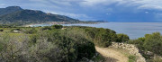
The Agriate (Conservatoire du Littoral): protected by the Conservatoire du Littoral, the Agriate is a natural jewel. I follow the recommended itineraries and do not bivouac or light fires.
Losari (Conservatoire du Littoral): I explore the uncontaminated beauty of Losari, following the recommended itineraries and avoiding any disturbance to the flora and fauna.
Ostriconi: I contribute to the preservation of this fragile ecosystem by avoiding any behaviour likely to disturb the flora and fauna.
In the event of problem (lack of markings, maintenance problems, environmental problems...), do not hesitate to signal this problem by using the reporting tool available on the route page, on the website (button under the map) or in the mobile app. You will be able to geolocate the problem and also send a corresponding photo. The Espace manager will be automatically notified of your report and will be able to check and deal with the problem.

the digital trails


![]()
Infos & contacts
Tourism Office
Île Rousse Balagne
+33(0)4 95 60 04 35

